
INFOS
Integrated Nowcast/Forecast Operation System
for Yahara Lakes
Hydrologic Modeling
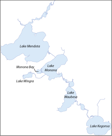
Select a lake by clicking on the name or map to show graphs of nowcast hydrologic modeling results.
Hydrologic Model Description
The hydrologic model provides water levels and runoff simulations (tributary inflows) for the Yahara Lakes (Mendota, Monona, Wingra, Waubesa, and Kegonsa). The model ingests high-resolution precipitation data, streamflow measurements from USGS and INFOS gages, and local meteorological observations to simulate a water budget within each lake's watershed. Runoff is processed through a split-abstraction engine that isolates urban impervious areas within each watershed, applying a strict initial abstraction threshold to saturate before routing the volume through a synthetic unit hydrograph. The unit hydrograph uses the Bransby-Williams equation to match each watershed's physical slope, channel length, and drainage area. To prevent error from unmeasured inflows or groundwater fluxes, the module executes a 300-iteration parameter optimization loop paired with a 20-cycle feedback adjustment that continuously calibrates model results. The resulting lake water level graph compares simulation results (red lines) against observed data (black dots) to show how well the water budget has performed. Furthermore, a statistical analysis of Root-Mean-Square Error (RMSE) and Nash-Sutcliffe Efficiency (NSE) metrics to ensure highly precise modeling capability. Under this framework, an RMSE below 0.05 feet is considered excellent, indicating the model's calculated water line matches true lake gauges within fractions of an inch. An NSE above 0.75 represents an exceptionally high-performing simulation with high mathematical reliability, while an NSE approaching 1.0 indicates near-perfect replication of real-world storm responses and watershed behaviors.